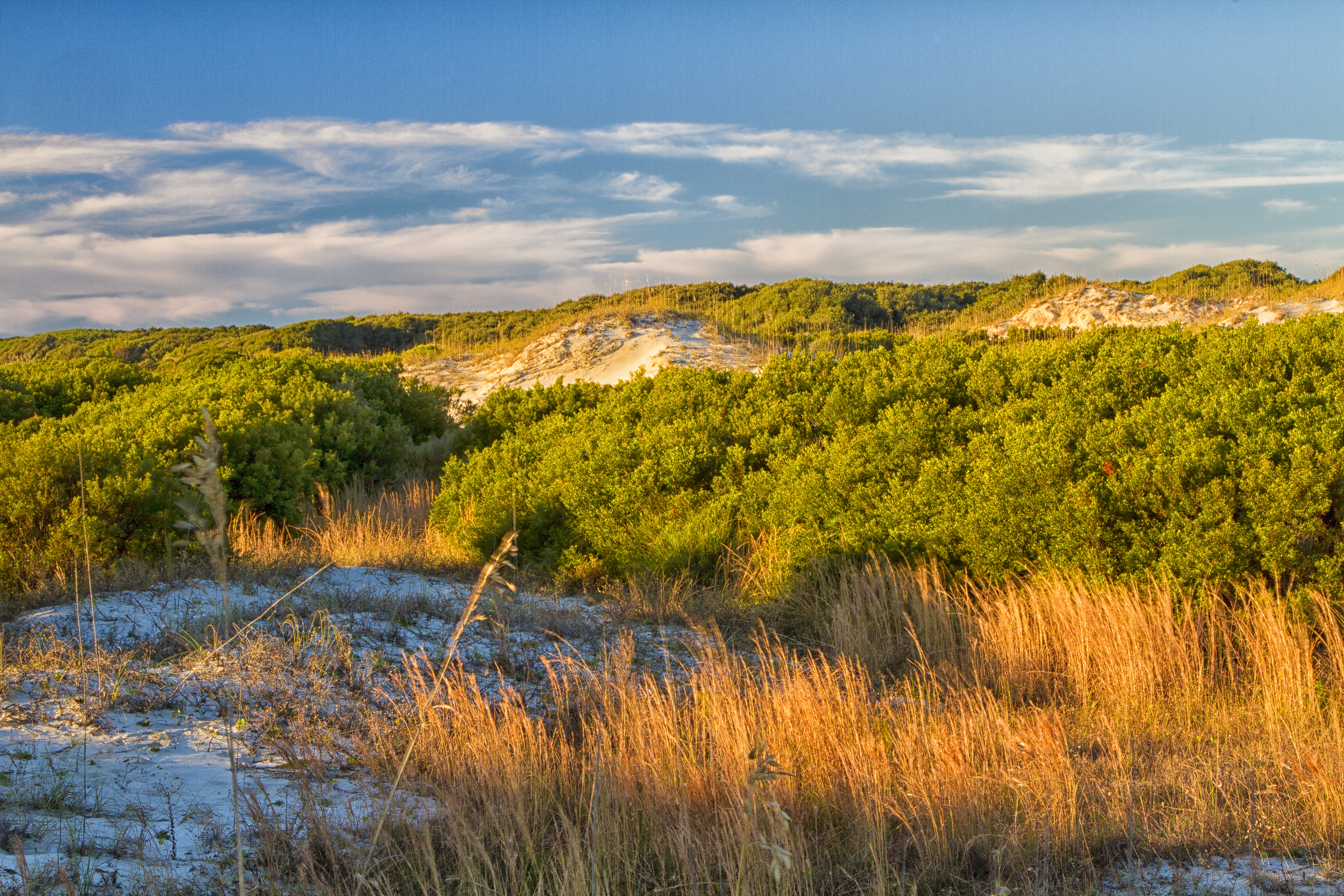
Vegetation holds dunes in place providing a barrier to erosion forces and creating essential interdune meadows to support island life.
Cumberland Island National Seashore
National Seashore · GA
St Marys is the gateway to Cumberland Island, Georgia's largest and southernmost barrier island. Here pristine maritime forests, undeveloped beaches and wide marshes whisper the stories of both man and nature. Natives, missionaries, enslaved African Americans and Wealthy Industrialists all walked here. Cumberland Island is also home to over 9,800 acres of Congressionally designated Wilderness.
Park report
Alert: Information
How this is rated
Poor: closures/hazards · Fair: cautions/noticesMainland Museum Closure
Alert: Caution
How this is rated
Poor: closures/hazards · Fair: cautions/noticesBurn Ban in Effect
Alert: Information
How this is rated
Poor: closures/hazards · Fair: cautions/noticesOngoing Road Repair on Main Road
Alert: Caution
How this is rated
Poor: closures/hazards · Fair: cautions/noticesScam Warning - Book ferry tickets through concessioner site only
Fee: Entrance - Per Person
How this is rated
Good: free · Fair: ≤$20 · Low: >$20$15
Campgrounds Available
How this is rated
Good: campgrounds available in this park5 campgrounds
Campground: Brickhill Bluff Wilderness Campsite
GoodBrickhill Bluff Wilderness Campsite is one of three campgrounds in Cumberland Island’s designated wilderness on the northern part of the island. The campsite is located 10.5 miles north of the Sea Camp dock. Wilderness sites have no amenities. Fires are prohibited, but camp stoves can be used for co
Campground: Hickory Hill Wilderness Campsite
GoodHickory Hill is one of three campgrounds in Cumberland Island’s designated wilderness on the northern part of the island. The campsite is located 5.5 miles north of the Sea Camp dock. Wilderness sites have no amenities. Fires are prohibited, but camp stoves can be used for cooking. Campers should be
Campground: Sea Camp Campground
GoodSea Camp Campground is located a half mile from the Sea Camp dock. All sites are walk-to, tent sites and campers are responsible for transporting all gear. Carts can be used. There are flush toilets, drinking water, cold showers, and a dish washing sink. Each site has a fire ring with grill, picnic
Campground: Stafford Beach Campground
GoodStafford Beach Campground requires a three and a half mile hike from Sea Camp. All sites are walk-to, tent sites and campers are responsible for transporting all gear. Carts of any kind or wheeled coolers cannot be used to haul gear. The site has flush toilets, cold showers, and water spigots with p
Visitor Centers
Good3 visitor centers
Activities Available
How this is rated
Good: many activities available11 activities
Park Name
InfoCumberland Island National Seashore
Designation
InfoNational Seashore
State(s)
InfoGA
Phone
Info9128824336
cuis_info@nps.gov
Operating Hours
InfoThe park is open 24 hours a day, all year. The island is only accessible by boat. The visitor center, other facilities, ferry operations, and docks for private boats all have separate hours, however; please see descriptions of those facilities elsewhere.
Visitor Center: Mainland Museum
InfoSee park for hours
Visitor Center: Mainland Visitor Center
InfoSee park for hours
Visitor Center: Sea Camp Ranger Station
InfoSee park for hours
Activity: Biking
InfoAvailable
Activity: Boating
InfoAvailable
Activity: Camping
InfoAvailable
Activity: Guided Tours
InfoAvailable
Activity: Hiking
InfoAvailable
Activity: Hunting and Gathering
InfoAvailable
Activity: Hunting
InfoAvailable
Activity: Swimming
InfoAvailable
Activity: Saltwater Swimming
InfoAvailable
Activity: Wildlife Watching
InfoAvailable
Activity: Birdwatching
InfoAvailable
Theme: Animals
InfoFeatured at this park
Theme: Fire
InfoFeatured at this park
Weather Info
InfoCumberland Island’s climate is hot and humid during summer when temperatures tend to be in the 80's (>26 C) and mild during winter when temperatures tend to be in the 60's (<20 C). The warmest month o
Getting There
InfoCumberland Island is only accessible by ferry or private boat. These directions are to the mainland visitor center in St. Marys, GA. Driving Directions To reach the visitor center from Interstate 95:
GPS Coordinates
Info30.8586° N, -81.4525° W
Data from official federal recreation records. Updated periodically. Park conditions change — always verify with the park before visiting. Verify on official park website