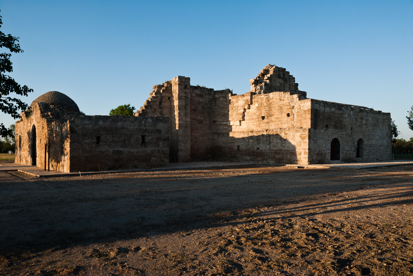
Construction of the mission church began in 1760 but was never completed. The outstanding ruins are virtually the only visible remains of the complex of missions established in the area. The purpose was to convert Coahuiltecan Indians to Catholicism.
El Camino Real de los Tejas National Historic Trail
National Historic Trail · TX, LA
Explore a diverse array of histories contained within El Camino Real de los Tejas’ 150-year life, including the Spanish struggle to missionize American Indian nations, the growth of cattle ranching in the Mexican period, and the movement for Texan independence and statehood.
Park report
Current Alerts
How this is rated
Good: no active alerts or closuresNo active alerts
Entrance Fee
How this is rated
Good: free entryFree — no entrance fee
Activities Available
How this is rated
Good: many activities available4 activities
Park Name
InfoEl Camino Real de los Tejas National Historic Trail
Designation
InfoNational Historic Trail
State(s)
InfoTX, LA
Phone
InfoN/A
ntir_information@nps.gov
Operating Hours
InfoEl Camino Real de los Tejas National Historic Trail is not a clearly marked hiking trail. Instead it is a route that passes through communities, urban areas, public lands, and Wilderness. The route travels across a variety of land ownerships and management, including private land. Each location varies as to the hours of operations and access. Please contact individual trail sites before your visit for more information.
Campgrounds
InfoNo campgrounds listed
Themes & Topics
InfoArchitecture and Building, Archeology, Arts + 11 more
Weather Info
InfoDue to the length of El Camino de los Tejas National Historic Trail, be sure to consult local weather sources for the region you'll be visiting. Check out the forecast with the National Weather Servic
Getting There
InfoYou can visit many sites of the El Camino Real de los Tejas National Historic Trail over the 2,580-mile historic route that crosses 2 states, and travels into Mexico, to Mexico City.
Location
Info30.0923° N, -97.3398° W
Data from official federal recreation records. Updated periodically. Park conditions change — always verify with the park before visiting. Verify on official park website