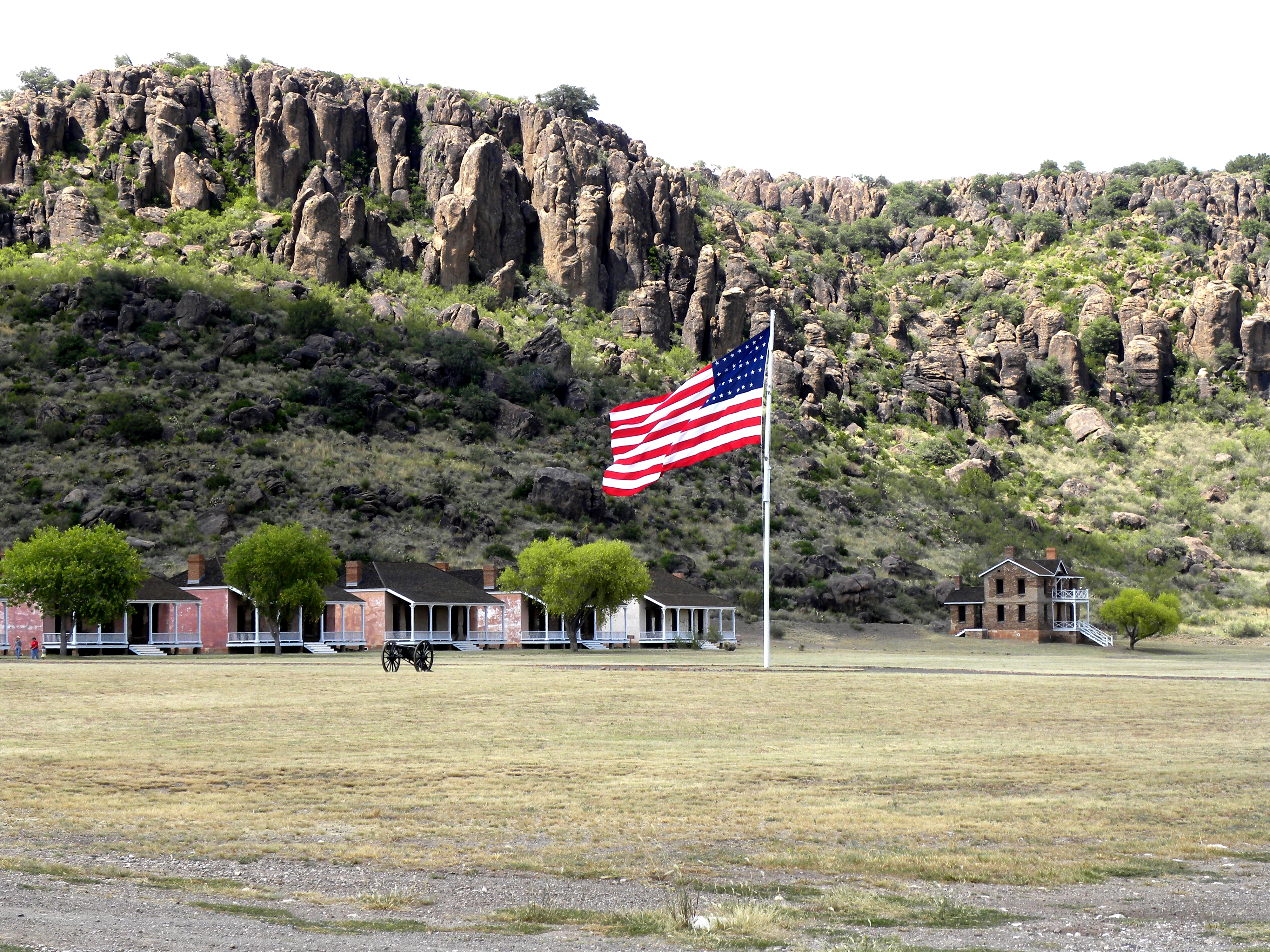
Garrison flag flying over the post within the box canyon Fort Davis is located.
Fort Davis National Historic Site
National Historic Site · TX
Fort Davis is one of the best surviving examples of an Indian Wars' frontier military post in the Southwest. From 1854 to 1891, Fort Davis was strategically located to protect emigrants, mail coaches, and freight wagons on the Trans-Pecos portion of the San Antonio-El Paso Road and on the Chihuahua Trail.
Park report
Alert: Park Closure
How this is rated
Poor: closures/hazards · Fair: cautions/noticesTall Grass Loop and Scenic Overlook Trails closed
Fee: Entrance - Per Person
How this is rated
Good: free · Fair: ≤$20 · Low: >$20$10
Fee: Entrance - Motorcycle
How this is rated
Good: free · Fair: ≤$20 · Low: >$20$15
Fee: Entrance - Private Vehicle
How this is rated
Good: free · Fair: ≤$20 · Low: >$20$20
Hours Exceptions
NoteClosed Thanksgiving Day; Closed Christmas Day; Closed New Year's Day; Closed Martin Luther King, Jr. Day
Visitor Centers
Good1 visitor center
Activities Available
How this is rated
Good: many activities available19 activities
Park Name
InfoFort Davis National Historic Site
Designation
InfoNational Historic Site
State(s)
InfoTX
Phone
Info1-432-426-3224
FODA_Superintendent@nps.gov
Pass: Annual Entrance - Park
Info$35
Operating Hours
InfoDaily Hours are 8:00 AM - 5:00 PM Holiday Closures: Thanksgiving Day, Christmas Day, New Year's Day, and Martin Luther King Jr. Holiday.
Campgrounds
InfoNo campgrounds listed
Visitor Center: Visitor Center
InfoSee park for hours
Themes & Topics
InfoArchitecture and Building, African American Heritage, Forts + 19 more
Weather Info
InfoSummer Temperatures average a High of 95 and low of 65. Winter Temperatures average a High of 60 and a low of 20. Wind is very common and heavy rainfall is very sporadic.
Getting There
InfoWe are approximately 2.5 hours south of Midland/Odessa starting on I-20 to HWY 17, 3.5 hours North West of Del Rio starting on HWY 90 to HWY 118, 4 hours east of El Paso starting on I-10 to HWY 118 an
Location
Info30.5993° N, -103.8962° W
Data from official federal recreation records. Updated periodically. Park conditions change — always verify with the park before visiting. Verify on official park website