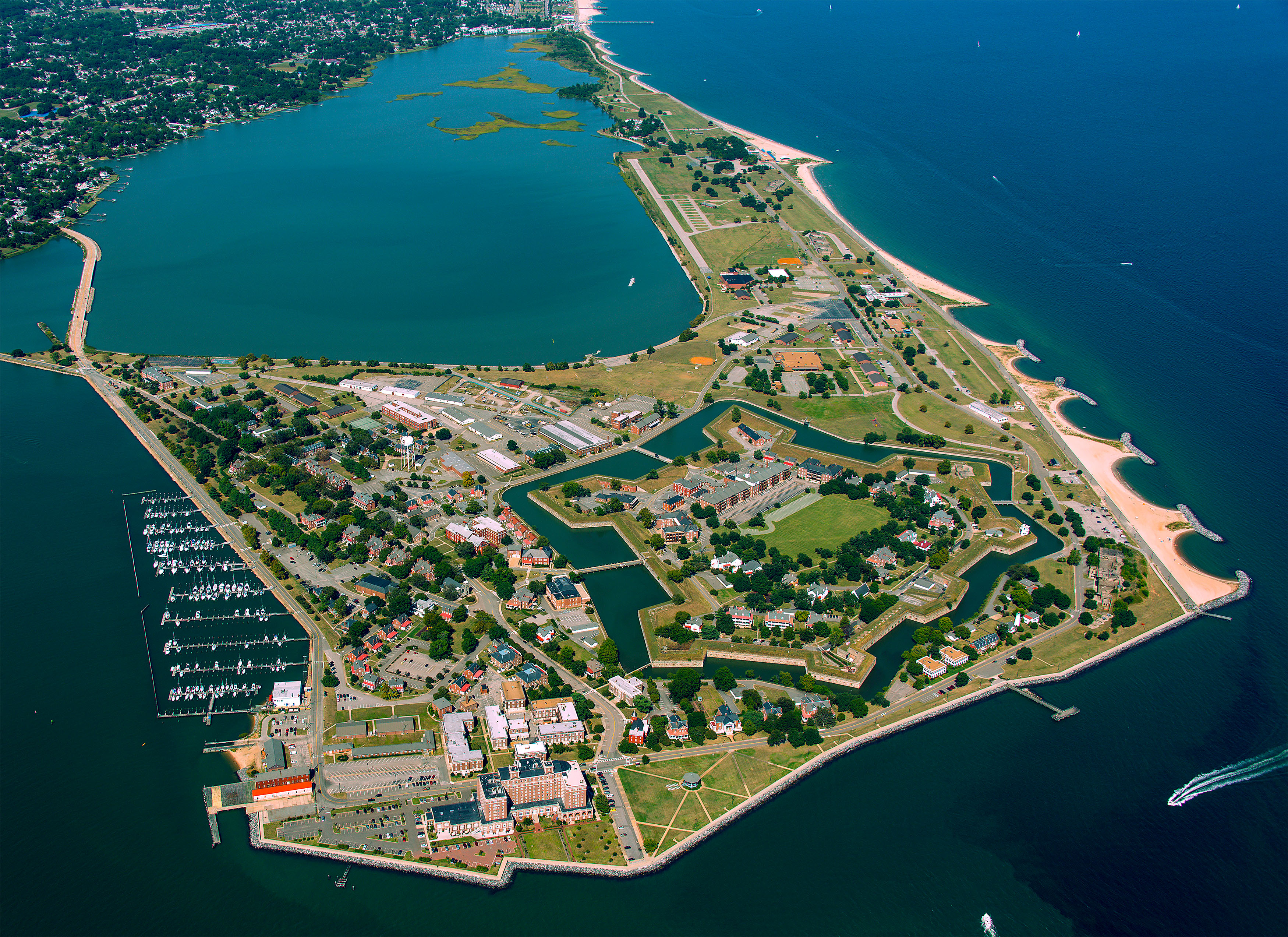
A unique perspective only available from the air brings the entire scope of Fort Monroe into focus in one image.
Fort Monroe National Monument
National Monument · VA
Fort Monroe's story spans from prehistory to the 2000s. Kecoughtan Indians occupied Old Point Comfort before the arrival of English colonists. The first enslaved Africans arrived in 1619. Those escaping slavery sought their freedom at the fort during the Civil War. The fort remained bastion of national defense until 2011, when it became a national park.
Park report
Alert: Park Closure
How this is rated
Poor: closures/hazards · Fair: cautions/noticesRoad Closure and Fishing Pier Impact
Alert: Information
How this is rated
Poor: closures/hazards · Fair: cautions/noticesReminder: Look Before Parking
Entrance Fee
How this is rated
Good: free entryFree — no entrance fee
Campgrounds Available
How this is rated
Good: campgrounds available in this park1 campground
Visitor Centers
Good2 visitor centers
Activities Available
How this is rated
Good: many activities available17 activities
Park Name
InfoFort Monroe National Monument
Designation
InfoNational Monument
State(s)
InfoVA
Phone
Info757-722-FORT (3678)
fomr_interpretation@nps.gov
Operating Hours
InfoFort Monroe National Monument is open year-round for outdoor activities like walking and exploring the historic grounds. Residents occupy many of the buildings. Respect their privacy by not peering into windows or opening gates.
Visitor Center: Fort Monroe Visitor & Education Center
InfoSee park for hours
Visitor Center: Casemate Museum
InfoSee park for hours
Themes & Topics
InfoArchitecture and Building, Archeology, Colonization and Settlement + 23 more
Weather Info
InfoSpring: Temperatures range from 40 F to 70 F with rain being common. Summer: Temperatures range from 75 F to 100 F with rain and sun equally common. On very sunny days, be prepared with plenty of wate
Getting There
InfoTake exit 268 from Interstate 64 (I-64) in Hampton, Virginia toward Fort Monroe. Turn left from the exit ramp onto South Mallory Street. Turn right at the second light onto East Mellen Street. Cross t
Location
Info37.0173° N, -76.3010° W
Data from official federal recreation records. Updated periodically. Park conditions change — always verify with the park before visiting. Verify on official park website