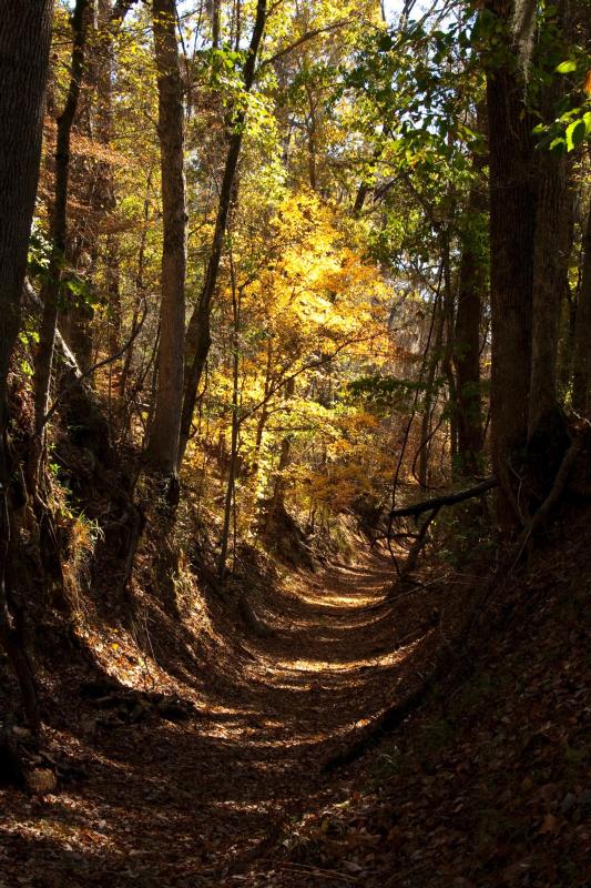
The Potkopinu section, between milepost 17 and 20, follows the historic Old Trace. The "sunken" nature of the trail is due to the footsteps of thousands of travelers between the 1780s and 1820s in the soft loess soil.
Natchez Trace National Scenic Trail
National Scenic Trail · AL, MS, TN
The Natchez Trace National Scenic Trail is five sections of hiking trail running roughly parallel to the 444-mile long Natchez Trace Parkway scenic motor road. The foot trails total more than 60 miles and offer opportunities to explore wetlands, swamps, hardwood forest, and the history of the area.
Park report
Current Alerts
How this is rated
Good: no active alerts or closuresNo active alerts
Entrance Fee
How this is rated
Good: free entryFree — no entrance fee
Visitor Centers
Good1 visitor center
Activities Available
How this is rated
Good: many activities available3 activities
Park Name
InfoNatchez Trace National Scenic Trail
Designation
InfoNational Scenic Trail
State(s)
InfoAL, MS, TN
Phone
Info662-680-4027
natr_interpretation@nps.gov
Operating Hours
InfoThe Natchez Trace National Scenic Trail is open every day during daylight hours. Severe weather resulting in washouts and downed trees can cause temporary trail closures. The trail is located entirely within the property boundaries of the Natchez Trace Parkway and questions about the trail and its condition should be directed to the Parkway's visitor center by calling 662-680-4027.
Campgrounds
InfoNo campgrounds listed
Visitor Center: Natchez Trace Parkway Visitor Center
InfoSee park for hours
Themes & Topics
InfoTrails
Weather Info
InfoMississippi, Alabama, and most of Tennessee are classified as humid subtropical climates. The weather ranges from mild winters to hot summers. Average high temperatures reach into the high 80's in sum
Getting There
InfoDirections to the Natchez Trace National Scenic Trail vary greatly depending on what section you are trying to reach. For specific questions concerning how to get to a certain section or trail head of
Location
Info34.3303° N, -88.7100° W
Data from official federal recreation records. Updated periodically. Park conditions change — always verify with the park before visiting. Verify on official park website